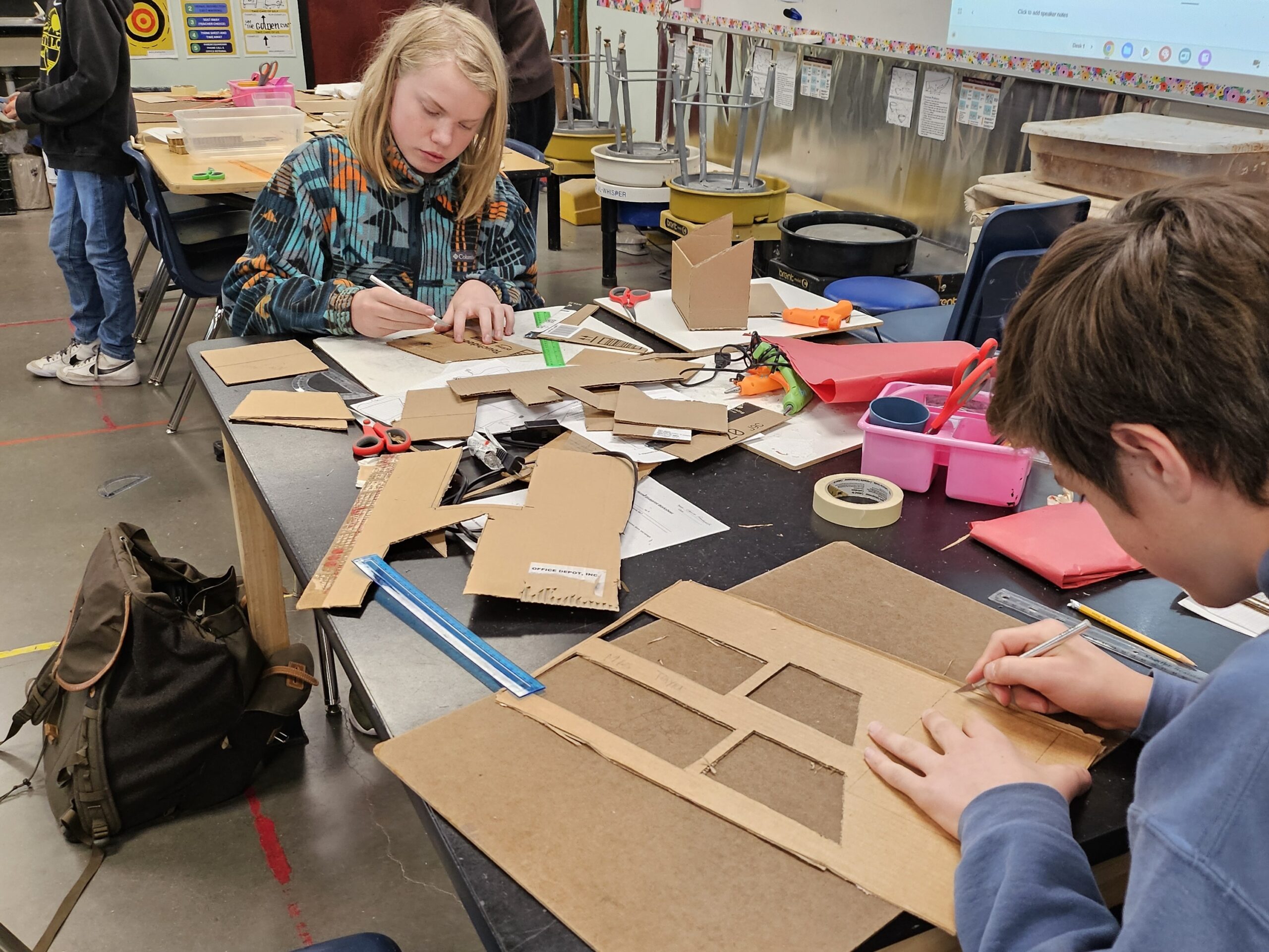
The new art installation in the Auditorium is a topographical map of the Park City Ridgeline. It is the culmination of three years of planning by the Art Department, and the creative efforts of students in grades 6, 7, and 8. The project was conceived just as COVID-19 sent schools into remote learning, was recommenced this fall, and was finally completed at the end of Winter Term.
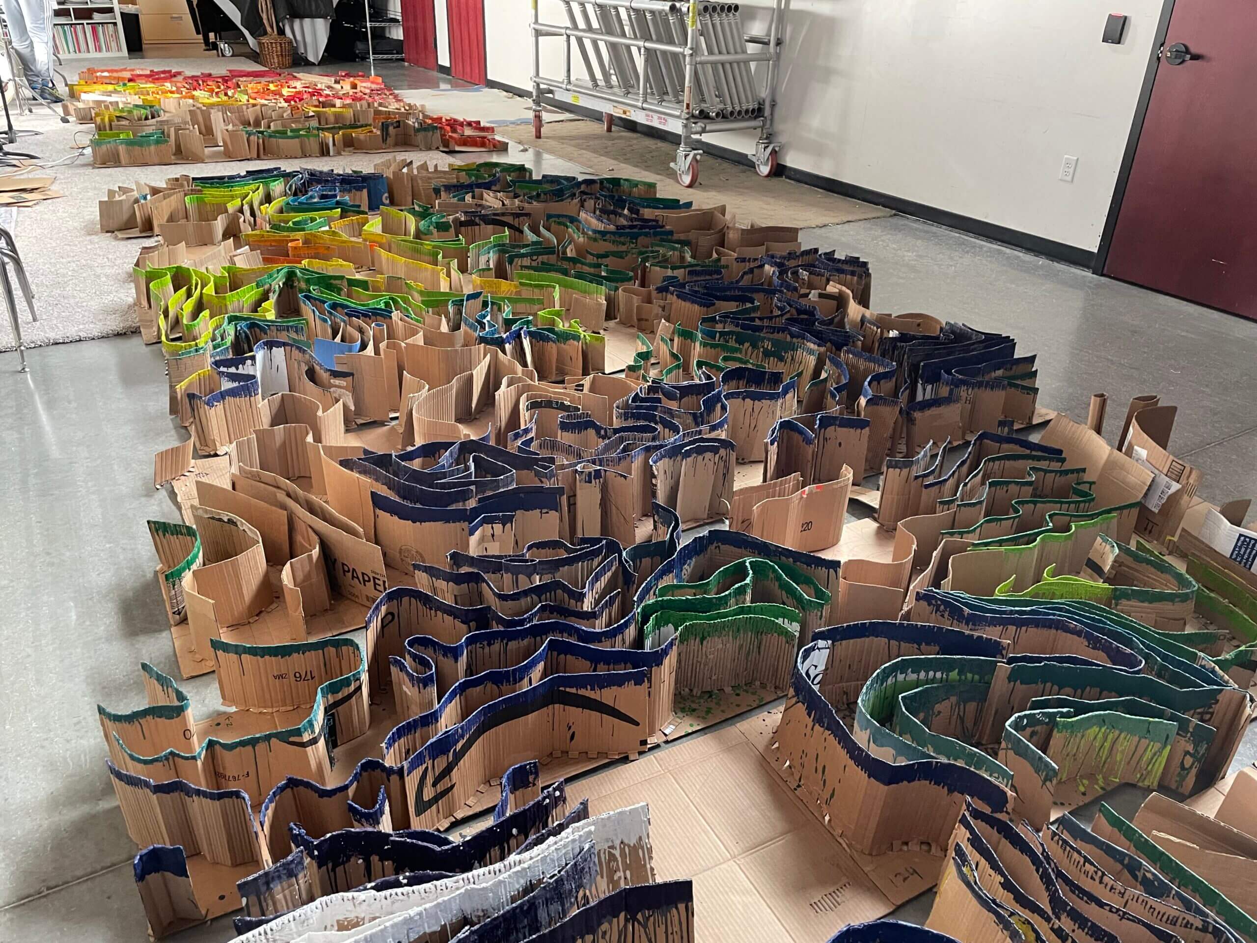
“Each student was given a square section of the ridgeline,” explains art teacher, Stephen Phillips. “They had to figure out elevation gains in 200 ft. increments, just like a topographical map, and then build a 3D model using found materials.”
Students recycled cardboard and melted crayons to create the map. They colored their ridges based on elevation (8,000 ft., 10,000 ft., etc.) and then numbered their square sections. When all the sections were completed, they were assembled according to number and put in place on the high wall behind the stage.
“This project quite literally immersed students in their local landscape,” observes art teacher, Nathan Florence,“ which was one of the exciting things about it. The creativity, collaboration, and crossover with physical science – that was pretty great, too!”